


|
|
|
|
|
|
|
|
| After a thorough examination of the water passage which linked Mornig cave with Comici cave, we concluded that the logical target of the further exploration was the Ramo degli Inglesi series. The series is located in the point where a considerable amount of water flows from Abisso Mornig cave into Abiusso Emilo Comici cave. The above series had been visited only once, long time ago, by the Italian-British team. However, due to threat of water rise, they did not manage to complete the exploration. Unfortunately, neither did we. Therefore, we still do not know what happens to the water flowing into the Ramo degli Inglesi. |
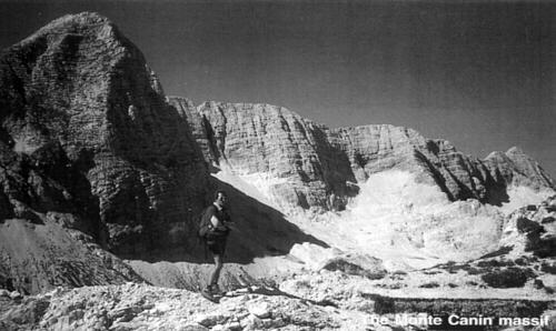 Photo by M. Gradzinski |
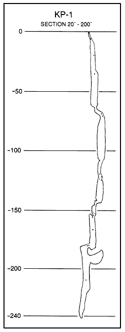
The most recent of our explorations took place in February 1997, that is in the spell of worm weather and snow melting. The water rise prevented us from reaching the end of the series we intended to explore. In spite of this, we were able to take measurements of 470 m passages in the Ramo degli Inglesi. We hope to be more successful during our next expedition.
In the course of the expeditions we have hitherto taken we found the linkage between Abisso Emile Comici and Abiso Mornig caves which form Complesso del Foran del Muss cave system. On the whole, we discovered and measured 1462 m of new passages in the above system. Nowadays there are 15 entrances to the system, which in this respect places it in the first position in Italy.

|
|
The Julian - Slovenia Lubomir Zawierucha Speleoklub Bielsko-Biala Speleoklub Bielsko-Biala made two summer exploratory expeditions to the Julian Alps in Slovenia in 1993 and 1994. We worked in the area of Kriški Podi in the Triglav National Park. The expeditions were made possible by the assistance of Professor Jurij Kunaver from the university in Ljubljana, to whom we herewith express our sincere thanks. Our activity was focused on the area between the peak Razor (2601 m) and Kriški Podi and its surrounding. The area is delimited on the east by the valley of Vrata, on the south by the valley of Zadnijca, on the west by the Vršič pass, and on the north by the Krnica valley. Kriški Podi are built of massive Dachstein Limestone, up to 2000 m thick. The strata dip generally southeast. The whole massif is bound by two deep faults, one running along the line Krajnska Gora - Vršič pass - Zadnja Trenta bounds the exploration area on the west and the other one - Luknja - Zadnjica - bounds it on the east. A distinct submeridionally running fault is discernible within the area of exploration along the valley east of Razor. There is also a network of fractures perpendicular to the Luknja fault. They control the numerous depressions in the relief (rifts, clefts, hanging valleys, deeply incised passes).
The area of exploration is situated above 1900 m and it lies above the timberline. Annual precipitation exceeds 2000 mm. The whole area has typical forms of alpine karst. Vast areas are covered with lapies. Its main concentration occurs within the glacial cirque Zgornje and Srednje Kriška Jezero, Stenarjeva Planja, eastern part of the valley and below Razor, and
|
 |
|
|
|
|
|
|
|
|
